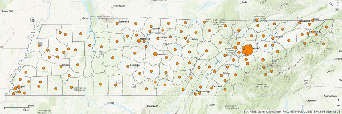
An interactive ArcGIS map was created to illustrate the reach of engagement and outreach projects across the state and beyond. Geographic Information Systems (GIS) software has many spatial capabilities. Stakeholders can click on stick pins to view project summaries.